| Boing Boing ( @ 2013-03-28 11:38:00 |
|
|
|
|
|
|
|
|
|
|
|
|
|
|
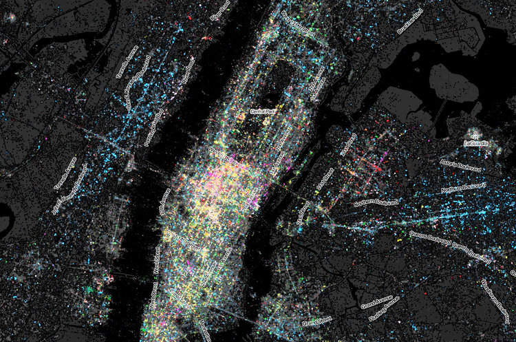
Mapping Twitter tongues of New York City


8.5 million geolocated tweets.
Above: a map created by James Cheshire, Ed Manley, and John Barratt, who collected 8.5 million geo-located tweets between January 2010 and February 2013.
Fast Company Design reports: "To build the image itself, they placed a point every 50 meters across the city. Tweets falling in close proximity were translated into a grid that you see here."
Among the revelations: Midtown is massively multilingual, "like a someone spilled a jar of confetti across the island."
More: Infographic: The Languages Of New York, Mapped By Tweets![]()


